Understanding the Mt Fuji Eruption Threat in 2026
Mount Fuji, Japan's tallest peak at 3,776 meters, is one of the most iconic landmarks on Earth. Yet beneath its perfectly symmetrical cone lies an active stratovolcano that has erupted numerous times throughout recorded history. For millions of tourists who visit the Fuji region each year — and for the roughly 30 million people living in the greater Tokyo metropolitan area — the question of whether Mt Fuji could erupt again is not merely academic. It is a matter of genuine preparedness.
This article provides a comprehensive look at the eruption history of Mt Fuji, the current volcanic risk assessment, what scientists and the Japanese government are doing to prepare, and what travelers should know before planning a trip to the region.
-

-
Mt Fuji: The Ultimate 2026 Guide to Japan's Iconic Mountain
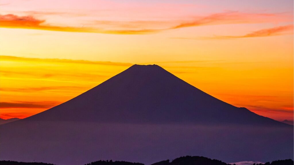
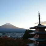
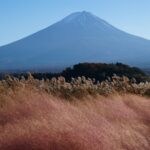
Why Mt Fuji Captivates Millions of Visitors Every Year Mt Fuji — or Fujisan (富士山) as it is known in Japanese — stands at 3,776 meters (12,389 feet), making it the tallest peak in Japan. Its near-perfect symmetrical cone, capped with snow for much of the year, has been a symbol of Japan for centuries. In 2013, UNESCO designated Mt Fuji as a World Cultural Heritage Site, recognizing not just its geological significance but its deep influence on Japanese art, literature, and spirituality. Whether you want to climb to the summit, photograph the mountain from a picturesque lake, soak in ...
続きを見る
A Complete History of Mt Fuji Eruptions
Mount Fuji has been volcanically active for approximately 100,000 years. Geologists divide its eruptive history into four main stages: Sen-komitake, Komitake, Old Fuji (Ko-Fuji), and New Fuji (Shin-Fuji). The modern cone that we recognize today was largely formed during the New Fuji period, which began roughly 10,000 years ago.
Major Eruptions in Recorded History
There have been at least 17 confirmed eruptions since 781 AD, when the first eruption was documented in Japanese historical records. Some of the most significant include:
- 864 AD — Jōgan Eruption: One of the largest eruptions in Mt Fuji's recorded history. Massive lava flows from the northwestern flank poured into the ancient Lake Senoumi, splitting it into what is now Lake Saiko and Lake Shōji. The lava field from this eruption created the Aokigahara forest floor.
- 1033 AD: A moderately large eruption that produced lava flows on the eastern slope.
- 1083 AD: Another significant eruption, though less well-documented than the Jōgan event.
- 1707 AD — Hōei Eruption: The most recent and one of the most devastating eruptions. Triggered approximately 49 days after the massive Hōei earthquake (estimated magnitude 8.6), this Plinian eruption lasted 16 days and deposited volcanic ash across a vast area, including Edo (modern-day Tokyo), roughly 100 kilometers to the northeast. The eruption created the prominent Hōei crater visible on Fuji's southeastern flank today.
The 1707 Hōei Eruption in Detail
The Hōei eruption is the most studied and the most relevant to modern risk assessment. Beginning on December 16, 1707, it ejected an estimated 0.68 cubic kilometers of tephra. Volcanic ash fell on Edo in layers several centimeters thick, disrupting daily life, contaminating water supplies, and damaging agriculture across the Kantō region. While no direct fatalities were recorded from the eruption itself, the subsequent famine and infrastructure damage caused significant hardship. The eruption was classified as VEI 5 (Volcanic Explosivity Index), making it a major event by global standards.
Current Volcanic Status of Mt Fuji
As of 2026, the Japan Meteorological Agency (JMA) classifies Mount Fuji at Volcanic Alert Level 1 ("Normal"), meaning there are no signs of imminent eruption. However, Level 1 does not mean the volcano is dormant or extinct — it simply indicates that current monitoring data shows no unusual activity.
What Scientists Are Monitoring
The JMA and multiple research institutions continuously monitor Mt Fuji using an extensive network of instruments:
- Seismometers: Detect volcanic tremors and earthquake swarms beneath the mountain. A notable swarm of low-frequency earthquakes occurred in 2000–2001, prompting increased surveillance.
- GPS and tiltmeters: Measure ground deformation that could indicate magma movement.
- Gas monitoring: Track sulfur dioxide and carbon dioxide emissions from fumaroles.
- Satellite InSAR: Detects subtle ground inflation or deflation over time.
Research published after the 2011 Tōhoku earthquake (magnitude 9.0) raised concerns that the seismic event may have increased pressure in Fuji's magma chamber. A 2012 study by the National Research Institute for Earth Science and Disaster Resilience estimated that the pressure beneath Fuji had risen to 1.6 megapascals — exceeding the 0.1 MPa threshold that triggered the 1707 eruption. While this does not mean an eruption is imminent, it underscores that the volcano remains very much alive.
What Would Happen If Mt Fuji Erupted Today?
Japanese authorities have developed detailed hazard maps and simulation models to predict the impact of a future eruption. The scenarios vary depending on the eruption type, but even a moderate event would have far-reaching consequences.
Ashfall on Tokyo and Surrounding Cities
The most widely discussed impact is volcanic ashfall. The Cabinet Office of Japan released a comprehensive report modeling a Hōei-scale eruption under modern conditions. If prevailing winds blow from the west (as they typically do), volcanic ash could reach central Tokyo within approximately two hours of eruption onset. Key projections include:
- 2–10 cm of ash across much of the Kantō Plain, including Tokyo, Yokohama, and Kawasaki.
- Transportation paralysis: As little as 1 mm of wet volcanic ash on rail tracks can halt train services. Airports such as Narita and Haneda would likely close. Highways would become impassable.
- Power grid disruption: Wet ash is conductive and can cause short circuits in power substations. Modeling suggests power outages could affect millions of households.
- Water supply contamination: Reservoirs and water treatment plants across the Kantō region could be compromised.
- Health hazards: Fine volcanic particles cause respiratory issues, particularly for children, the elderly, and those with pre-existing conditions like asthma.
Pyroclastic Flows and Lahars
For communities closer to the mountain — particularly towns like Fujiyoshida, Gotemba, and Fujinomiya — the risks extend beyond ashfall. Pyroclastic flows, superheated currents of gas and volcanic material traveling at over 100 km/h, could reach populated areas within minutes. Lahars (volcanic mudflows) caused by snowmelt mixing with volcanic debris pose additional risks, especially during winter months when Fuji's upper slopes are covered in snow.
Estimated Economic Impact
The Japanese government estimated in 2020 that a Hōei-scale eruption could cause approximately 2.5 trillion yen (roughly $17 billion USD) in damage, primarily from ashfall-related infrastructure disruption across the Kantō region. Some independent analyses suggest the total economic impact, including supply chain disruption and lost productivity, could be several times higher.
Japan's Eruption Preparedness and Evacuation Plans
Japan is one of the most volcanically prepared nations in the world, and Mt Fuji receives special attention given its proximity to the capital.
The Mt Fuji Hazard Map
The Mt Fuji Volcanic Disaster Prevention Council, comprising Shizuoka Prefecture, Yamanashi Prefecture, and relevant national agencies, maintains a detailed hazard map. Updated periodically, the map identifies zones at risk from lava flows, pyroclastic flows, ashfall, and lahars. It is publicly accessible and has been translated into multiple languages for the benefit of foreign residents and tourists.
In March 2021, the hazard map was significantly revised for the first time in 17 years. The updated version expanded the projected lava flow zones and increased the estimated magma volume for a potential eruption, reflecting new geological findings.
Evacuation Planning
Local governments around Mt Fuji have developed multi-tier evacuation plans. Approximately 750,000 residents live in the primary evacuation zone. The plans include:
- Phased evacuation based on eruption progression and alert levels.
- Designated shelter locations and evacuation routes.
- Coordination with the Self-Defense Forces for large-scale evacuation scenarios.
- Regular public drills and awareness campaigns.
For the Kantō region and Tokyo specifically, ashfall preparedness guidelines were issued by the national government, recommending that households stock goggles, N95-equivalent masks, and plastic sheeting to protect electronic equipment.
What Travelers Should Know About Mt Fuji Eruption Risk
For tourists planning to visit the Mt Fuji area or climb the mountain, the volcanic risk is understandably a concern. Here is practical guidance for 2026:
Is It Safe to Visit Mt Fuji?
Yes. At Volcanic Alert Level 1, Mt Fuji is considered safe for all normal activities, including climbing during the official season (typically early July to early September). The JMA continuously monitors the volcano, and any increase in risk would trigger an immediate upgrade in the alert level, along with public warnings and potential access restrictions.
How to Stay Informed
- JMA Volcanic Alerts: Available in English at the JMA website. Check before and during your trip.
- Safety Tips App: The NHK World app provides disaster alerts in English, including volcanic warnings.
- J-Alert: Japan's nationwide warning system broadcasts emergency alerts through mobile phones, including for volcanic events.
- Local tourism offices: Staff at Kawaguchiko Station, Fujiyoshida, and mountain huts can provide real-time safety updates.
Tips for Travelers in the Fuji Region
While the probability of an eruption during any given visit is extremely low, sensible precautions are always wise in a volcanically active region:
- Carry a dust mask or N95 mask in your day pack — useful for volcanic ash and general air quality.
- Ensure your travel insurance covers natural disasters, including volcanic events.
- Familiarize yourself with evacuation routes at your accommodation.
- Keep your phone charged and enable emergency alerts.
- If climbing Mt Fuji, register your climbing plan and follow all official guidelines.
-
-
Climbing Mt Fuji in 2026: The Complete Guide to Routes, Seasons, and What to Expect
Why Climbing Mt Fuji Should Be on Your Japan Bucket List Standing at 3,776 meters (12,389 feet), Mt Fuji is Japan's tallest peak and one of the most iconic mountains on Earth. Every summer, hundreds of thousands of hikers from around the world converge on its slopes to experience the once-in-a-lifetime thrill of climbing Mt Fuji. Whether you are drawn by the spiritual significance, the legendary sunrise from the summit, or simply the challenge of conquering an active stratovolcano, this guide covers everything you need to know about climbing Mt Fuji in 2026. The 2026 Climbing Season: When Is Mt ...
続きを見る
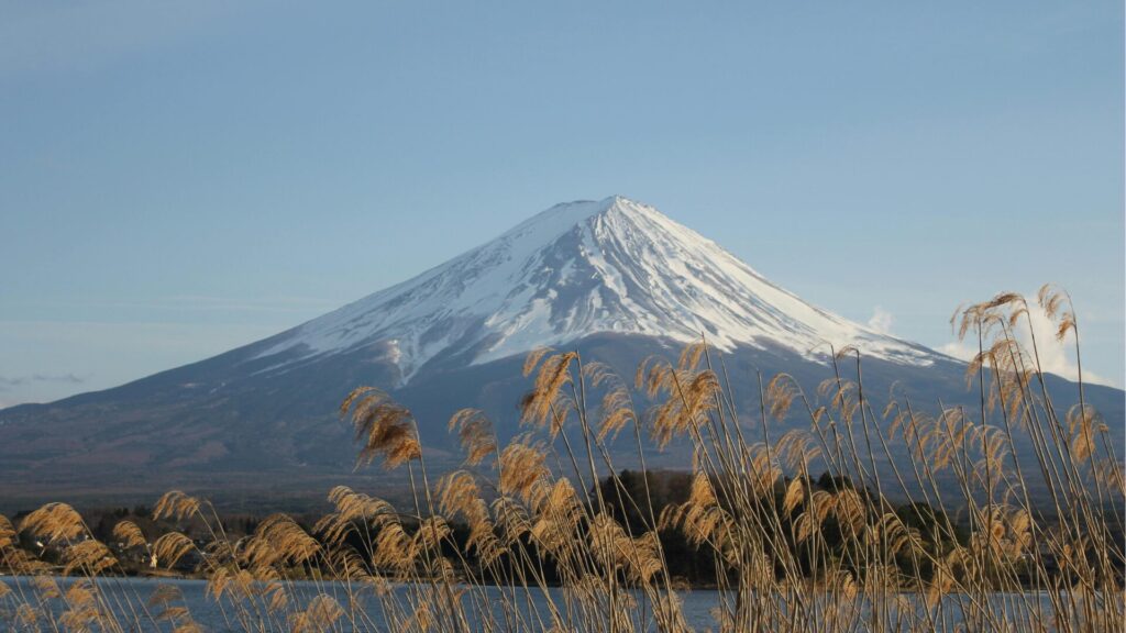
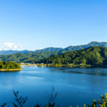
The Kawaguchiko Region and the Five Lakes
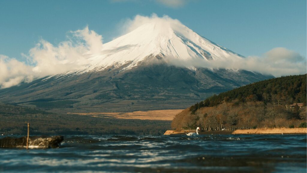
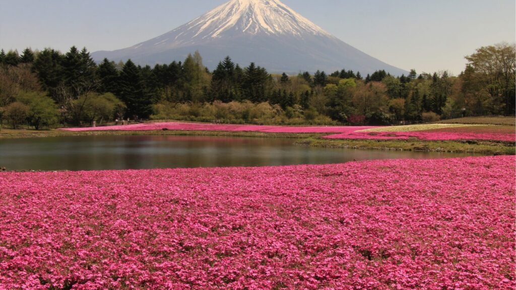
The Fuji Five Lakes area (Fujigoko) — comprising Kawaguchiko, Yamanakako, Saiko, Shōjiko, and Motosuko — sits on the northern base of Mt Fuji. This region is one of the most popular tourist destinations in Japan, offering stunning views of the mountain across mirror-still lake surfaces. Notably, several of these lakes were formed or reshaped by past eruptions, particularly the 864 Jōgan event.
The area is well-served by disaster prevention infrastructure, including signage indicating evacuation routes and shelters. Driving around the Five Lakes provides an excellent way to appreciate the volcanic landscape. From Tokyo, the journey to Kawaguchiko takes approximately 90 minutes by car via the Chuo Expressway, making it one of the most accessible day trips from the capital.
-
-
Drive from Tokyo to Kawaguchiko Onsen: The Ultimate Self-Drive Guide for Overseas Visitors
Planning to drive from Tokyo to Kawaguchiko onsen? This in‑depth guide covers routes, permits, parking, tolls, itineraries, and seasonal tips—everything you need to enjoy Lake Kawaguchiko and Mt. Fuji hot springs by rental car. Why Drive from Tokyo to Kawaguchiko Onsen? Driving gives you freedom to stop at scenic viewpoints, lesser‑known onsen ryokan, and cafés around the Fuji Five Lakes. Compared with trains and buses, a car lets you combine multiple sights in one day, travel early or late to avoid crowds, and carry luggage with ease. Quick Facts Distance & time: ~110–140 km from central Tokyo; 2–2.5 hours in ...
続きを見る
Could Mt Fuji's Next Eruption Be Predicted?
Modern volcanology has made significant advances, but predicting volcanic eruptions with precision remains one of the great challenges in earth science. For Mt Fuji specifically, several factors complicate prediction:
- Long repose periods: Over 300 years have passed since the last eruption in 1707, making it difficult to establish short-term patterns.
- Multiple eruption types: Fuji has produced both effusive (lava flow) and explosive (Plinian) eruptions, and different magma compositions have been involved. The next eruption could take various forms.
- Seismic triggers: The correlation between major earthquakes and Fuji eruptions (as seen in 1707) adds an additional variable that is itself difficult to predict.
That said, Japan's monitoring network is among the most advanced in the world. Scientists are confident that significant precursory activity — including increased seismicity, ground deformation, and gas emissions — would likely be detected weeks to months before a major eruption, providing time for escalated warnings and evacuation.
How Mt Fuji Compares to Other Active Volcanoes
To put the risk in perspective, Mt Fuji is far from the only active volcano in Japan. The country has 111 active volcanoes, approximately 10% of the world's total. In recent years, eruptions at Ontakesan (2014, which killed 63 hikers), Shinmoedake (multiple eruptions since 2011), and Suwanosejima (frequent eruptions) have been more immediately concerning than Fuji.
Globally, Mt Fuji's eruption frequency is relatively low compared to volcanoes like Etna in Sicily or Kīlauea in Hawaii, which erupt on far shorter cycles. However, when Fuji does erupt, the consequences are amplified by its proximity to one of the world's largest urban areas.
The Cultural Significance of Mt Fuji's Volcanic Nature
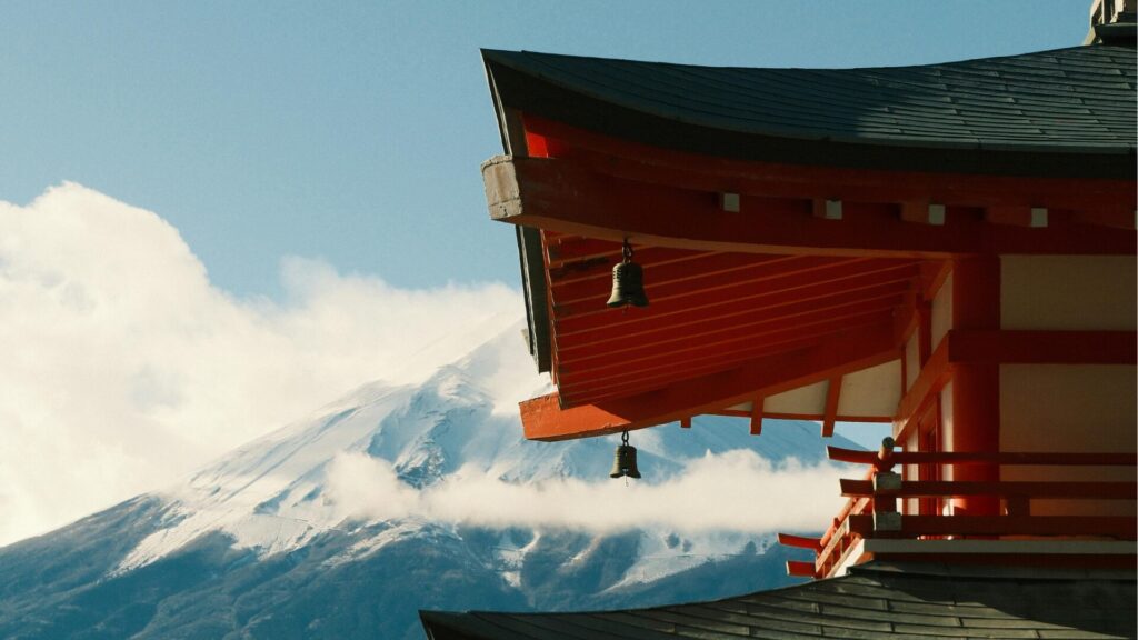
It is worth noting that the volcanic nature of Mt Fuji is inseparable from its cultural identity. The mountain's near-perfect conical shape — the very feature that has inspired centuries of art, poetry, and pilgrimage — is a product of volcanic eruptions that built the cone layer by layer. The Hōei crater, a scar from the 1707 eruption, is visible from Tokyo on clear days and serves as a permanent reminder of the mountain's power.
Shinto shrines at the summit and around the base of Fuji have long served as sites of prayer for protection from eruptions. The Sengen shrines, dedicated to the deity Konohanasakuya-hime, were historically built to appease the volcano. This intertwining of natural hazard and spiritual reverence is a defining characteristic of Japanese culture's relationship with the natural world.
-
-
Mt Fuji Weather: Monthly Conditions, Forecasts & Best Time to Visit in 2026
Understanding Mt Fuji Weather Before You Go Mt Fuji weather is notoriously unpredictable and dramatically different from conditions at lower elevations. Standing at 3,776 meters (12,389 feet), Japan's tallest peak creates its own microclimate that can shift from calm sunshine to fierce winds and freezing temperatures within minutes. Whether you are planning to climb the summit, photograph the mountain from surrounding lakes, or simply admire it from a distance, understanding Mt Fuji's weather patterns is essential for a safe and rewarding experience. This guide breaks down monthly weather conditions at the summit and base, explains seasonal visibility patterns, and offers ...
続きを見る
Final Thoughts: Respecting the Mountain
Mount Fuji's volcanic nature is not a reason to avoid it — it is a reason to understand and respect it. The mountain has been quiet for over three centuries, and Japan's world-class monitoring systems and preparedness infrastructure mean that the risk to visitors and residents, while nonzero, is carefully managed. For travelers in 2026, the most practical approach is to stay informed, follow official guidance, and appreciate that the same geological forces that created this UNESCO World Heritage site continue to shape it today.
Experience Japan’s Finest JDM Adventures
From Daikoku PA tours to JDM sports car rentals and drift experiences, we offer premium driving adventures for visitors who want more than ordinary sightseeing.
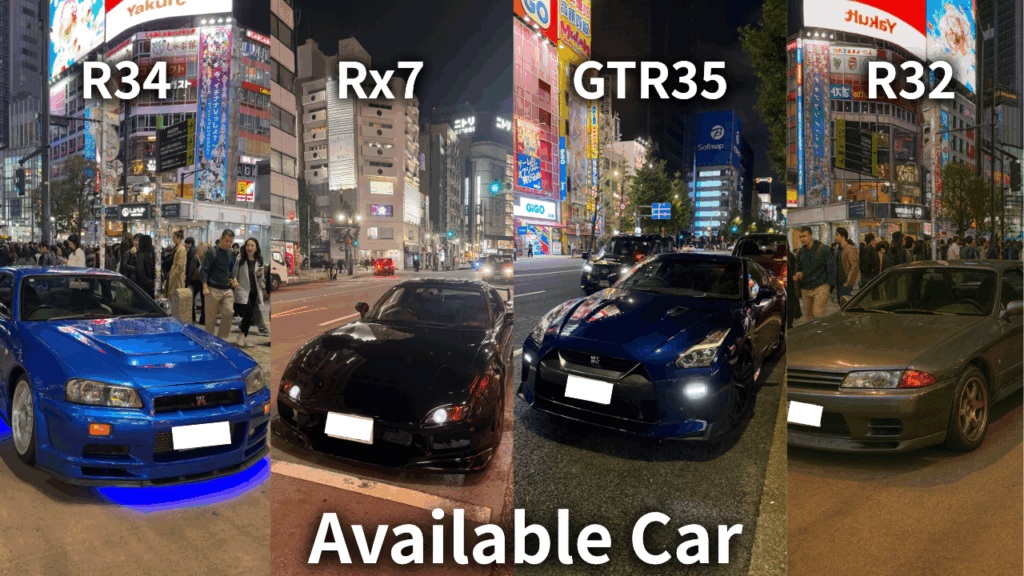
Get behind the wheel of iconic machines such as the GT-R, RX-7, and Supra, and experience Japan’s legendary car culture in the most unforgettable way. Whether you want a scenic Tokyo car experience or something more thrilling and immersive, we can guide you to the right plan.
Not sure which experience suits you best? No problem. Message us on WhatsApp and we’ll help you choose the ideal option based on your travel plans, interests, and driving experience.
Popular dates sell out quickly, so we recommend contacting us early.
Customer Reviews

Important Information
- This is a drive tour where you drive your rental car, and our guide navigates from the seat.
- This is a self-drive tour where you drive your rental car, and our guide navigates from the passenger seat.
- The tour begins and ends at the same location (Shibuya).
- If the Daikoku Parking Area is closed, we will instead guide you to another car meet further away.
- The consultant is a cultural expert and navigator, not a taxi service.